Showing posts with label Bagamanoc. Show all posts

Saturday, February 14, 2009

The Way We Were

Traveling or driving going to northern Catanduanes was really thrilling, challenging and fun particularly during the construction of the Catanduanes Circumferential Road Improvement Project (CCRIP) - Phase I. I used to drive at the 60 kilometers stretch many times. Maneuvering requires some intuition, guts and lots of common sense so as your vehicle would not be stuck in the mud and loose earth. Indeed, a big difference if one is used to city driving.

During my frequent trips, I used to wonder that the whole stretch could be a good venue for an off-road car rally. All the challenges were in placed, muddy and dry in some section, blind curves, uphill and downhill drives.

For the commuting public, at that time, one has to squeezed-in into overcrowded public vehicles. Average travel time then was 3-4 hours, yet I never heard anyone complained about their horrendous trip. All were anticipating for a better road.

In October 2007, the CCRIP - Phase I was completed and inaugurated.

In progress is the 120.36 km. from Viga to Codon, San Andres (CCRIP - Phase II) with an estimated budget cost of Php 2.8B.

RELATED LINKS:
  • The Road Going to North - Travelling from Virac to northern towns of Viga, Panganiban and Bagamanoc is much better off now compared to 4 years ago.
  • Catanduanes Skyway - Wild suggestion to initiate development of a cable car system to run from Bicol mainland up to northernmost town of Pandan.
  • The Catanduanes Circumferential Road Improvement Project (CCRIP) - October 22, 2007: Inaugurated was the 79.818-kilometer road stretching from San Andres to Viga and five (5) bridges, which are components of the fourth phase of the Arterial Road Links Development Project.

Thursday, February 5, 2009

The Old LORAN Station

I only passed once at this former US Coast Guard facility on Panay island when I was a growing-up kid. At that time, the station was no longer operational, but for the locals who used to be civilian employees, for them is a continuing saga. They would tell me stories about seaplanes delivering food supplies and mails, abundant supply of corned beef, men unafraid of rough seas and radar.

In my later years, I never had a chance to see LORAN upclose, though had a chance to meet former civilian employees.

The last time I heard someone talk about it, was from a resident at Panay island. He said that the former station was completely vandalized and the new occupants now are water buffalo.

There should be an initiative to maintain the facility not only as a tourist destination but as well as a historical reminder for our province and also in memory for those who were once part of the station.

A description of the air operations at LORSTA Catanduanes:

The island of Catanduanes lies 230 miles east-southeast of Sangley Point. The hilly terrain was unsuitable for an aircraft runway. The LORSTA, known simply as Cat, was situated at the north end of the island with a bay immediately to the west that was adequate for UF/HU-16 water operations as long as the wind and sea conditions were favorable. The aircraft tied up at a buoy and supplies were unloaded by small boat and transported to the boat dock. The bay was semi-exposed to the sea and when the incoming swells made the bay dangerous, landings were made at the south end of the bay. This was separated from the main bay by an island and coral reefs. The aircraft, when using the south bay had to be unloaded at anchor and supplies transported to the LORSTA.

source: www.uscgaviationhistory.aoptero.org/history02.html
photo: www.pbase.com/cesvaleza/loran

RELATED LINKS:

Friday, January 9, 2009

NDCC Report: Minor Flooding and Landslide

National Disaster Coordinating Council (NDCC) 7 January 2009 report.

Situation Overview
  • Governor Joseph C. Cua of Catanduanes Province DPWH 5 has confirmed that continuous rains which occured since last night triggered the occurrence of landslide and flooding along Circumferential Road in said province.
  • Sections were affected last night were Brgy Sipi, Bato; Bato-Linao; Tilod, Baras and Banabaan in Caramoran; and two sections along Baras-Gimoto Road.
One electric post in Viga-Bagamanoc Road collapsed due to landslide.

No casualty were reported in relation to landslide incident.

Road Condition as of 3:00 PM today, 7 January 2009
  • Virac-San Andres Road Section - passable until the area of Panabanaon as the chokepoint of the heavy landslide in the area.
  • San Andres-Caramoran-Pandan Road Section - impassable due to the chokepoint at the Panabanaon area which is totally under debris of mud, gravel and vegetation.
  • Virac-San Miguel Road Section - The Balonbong area had been blocked again by debris. This section has an intermittent occurence of landslides. Hence all types of vehicles cannot pass this section and commuters are now using Bato river to traverse.
  • Virac-Bato-Baras Road Section - passable until Bagumbayan, Baras and with landslide at Tilod and Batolinao, all of Baras.
  • Baras-Gigmoto Road Section - impassable due to landslide at Barangay Agban.
  • Gigmoto-Viga Road Section - impassable due to landslide at Villa Aurora.
  • Viga-Bagamanoc Road - now passable to tourist as clearing operations is ongoing.
Actions Taken
  • The First Catanduanes Electric Cooperative (FICELCO) is currently undergoing repair of collapsed post in Viga - Bagamanoc. Electricity is still cut off until the post is fixed.
  • DPWH is fast tracking the clearing operations in all landslide areas and monitoring all vital reports and situations including warning generations for all threats caused by the intermittent bad weather.
Issues and Concern
Catanduanes Province is now low on petroleum and LPG supplies due to the rough seas. There is an intermittent power outage in the entire island.

Wednesday, November 5, 2008

Town Fights Quarrying For Iron

BAGAMANOC, Catanduanes – Late in October, opposition from residents and the Catholic clergy in this province has prompted the Department of Environment and Natural Resources Mines and Geosciences Bureau (DENR-MGB) to issue a cease-and-desist order (CDO) against the magnetite (iron ore) extraction activities of Chinese firm Shun Fong Transport Co.
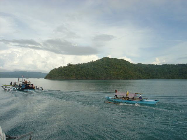
Bagamanoc
The CDO was based on findings of DENR-MGB investigators, who after conducting interviews with residents and company workers, determined that Shun Fong was engaged in the illegal extraction of black sand, locally known as “amargaja”, from Babaguan Bay along the coast of the two towns of Panganiban and Bagamanoc towns, located about 60 kilometers from the capital town of Virac.

The controversy erupted in the first week of September when concerned Bagamanoc residents noted the arrival of the Chinese firm, which began constructing a barge on the beach just a hundred meters away from the municipal hall.

They grew alarmed when they saw that the boat was going to be equipped with a suction pump and a magnetite processor, which workers said would be used to suck black sand offshore.

Wave erosion

Bagamanoc seawall
Days after the arrival of Shun Fong in their community, I-Care Bagamanoc, a nongovernment organization led by Fr. Juan Tejerero held a public assembly at the parish church where municipal officials led by Mayor Odilon Pascua were roundly criticized for allowing the mining activity despite the dangers posed to the environment.

During the last decades, the unprotected shoreline of Bagamanoc has been receding due to wave erosion, with the poblacion losing two streets to the sea so far. Current and past municipal administrations have been trying to extend a sea wall but the dearth of funds has prevented its full completion.

In an interview at his capitol office, Gov. Joseph Cua confirmed he has invited Henry Sy of Shun Fong Transport (with offices located in Greenhills, San Juan) to conduct preliminary reclamation work for planned reclamation projects in some coastal areas of the province.

The projects would pave the way for the construction of commercial and fishing ports in the municipalities where it is feasible.

Citing budgetary constraints of the provincial government, Cua said he asked Shun Fong to conduct surveys at no cost to the province, to determine the depth of the shoreline, the total area of the reclamation site, and the volume of earth fill needed.

He cited Bagamanoc and Panganiban towns as the priority sites.
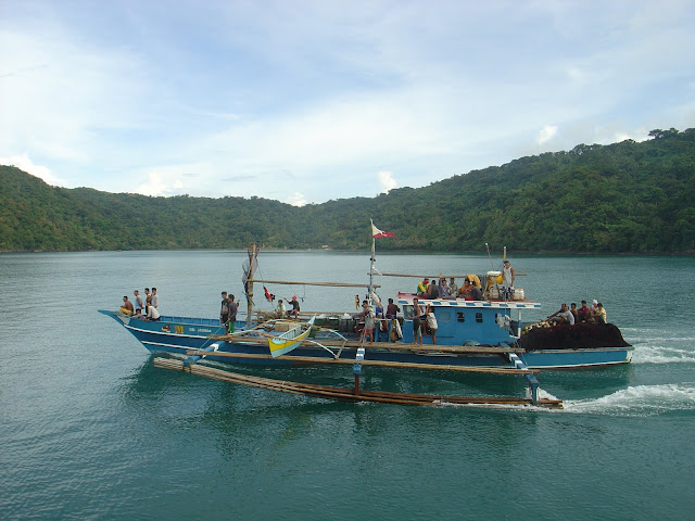
Boat load of iron ore
He added that the firm could have been in the process of conducting sedimentary sampling of the black sand, which is a raw material used for the production of metal, when the opposition to its activities grew.

He said that in magnetite mining, wherein black sand is siphoned off the sea floor and the magnetite removed by a magnetic separator aboard a vessel, only 6 percent of the sand is taken, with the 94 percent returned to the sea floor.

This unwanted quantity, the governor said, could be used in reclaiming the considerable land area that has been lost by Bagamanoc town to the advancing sea.

In an interview with the Inquirer early in October, Mayor Odilon Pascua shared the governor’s view and stressed that no magnetite extraction occurred on the shores of the coastal town.

The Sangguniang Bayan, headed by Vice Mayor Juan Velchez Jr., however, was opposed to Cua and Pascua’s views and asked Pascua to stop any illegal mining activity.

Velchez affirmed that as early as Sept. 8, they had invited the Chinese firm to shed light on the issue.

Pascua told the municipal officials that he had already relayed the request to Cua, who asked for some time to allow Shun Fong to finish construction of its barge.

At the end of September, Shun Fong towed its barge to Panganiban town and began extracting black sand from the shallow sea of Babaguan Bay prompting local fishermen to complain that the activity resulted in turbid waters and harmed fishpens in the area.

The town mayor, Gregorio Angeles, said he would not oppose magnetite mining within the territorial jurisdiction of the town, provided it is done offshore.

In an interview, he said the Chinese group is just conducting a survey of possible magnetite deposits before undertaking any mining activity.

In case mining takes place offshore, he added that the sand washed out of the magnetite separation process could be used to reclaim part of Panganiban’s shallow shore for the proposed commercial port.

Open letter
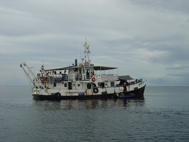
Historical and Nautical Archaeology Foundation (HNAF)
The views of the local government officials on the mining activities of Shun Fong, however, did not sit well with the Catholic leadership and clergy in the province.

After two days of intensive discussion, Bishop Manolo A. delos Santos and 29 priests of the Diocese of Virac wrote an open letter addressed to the public officials.

The letter demanded immediate cessation of the mining activity off the shores of Panganiban and Bagamanoc pending a full-blown investigation and public consultation on the already controversial issue.

Critics have brought their case to cyberspace via Youtube where a video dubbed “Amargaha” was uploaded while a group of Panganiban residents citing environmental concerns and transparency placed a half page ad in a local newspaper.

The clergy asked for pertinent information, especially on the possible environmental and socio-economic repercussions of the mining activity of Shun Fong.

They demanded that the results of the probe be made open to the stakeholders at the earliest possible time.

The bishop himself, accompanied by other parish priests, traveled to the company’s magnetite processing site in Barangay San Antonio in Panganiban last Oct. 25 to check the claims made by I-Care Bagamanoc.

Insiders said the bishop would bring a copy of the open letter to MalacaƱang to personally appeal for the intervention of President Macapagal-Arroyo.

When it received the manifesto of the clergy, the Sangguniang Panlalawigan promptly referred the matter to the Committee on Environment and Natural Resources headed by provincial board member Francisco “Jun” Camano, Jr.

Camano said he has yet to have a copy of the DENR order but will proceed with the investigation of the controversy anytime this November.

The local Catholic clergy had requested a copy of the DENR-EMB’s CDO order against Shun Fong from the provincial capitol but were told only that it was in the hands of special projects consultant Cham de Garcellanosa.

Capitol employees said the consultant had worked for the Lafayette mining company in Rapu-rapu, Albay before he was employed at the capitol.

In a chance interview at the provincial capitol, Shun Fong project coordinator Arnie Mesia said that in the aftermath of the controversy and CDO order, the company would lease a local boat to tow the barge used in the extraction to Virac and then to Sorsogon where he said local people are engaged in small-scale on-shore magnetite mining. However, rough seas have stranded the barge in Panganiban.

Mesa said the company would probably apply for a permit to explore and subsequently extract magnetite from a mountain-sized deposit located along a river somewhere between Barangays Hinipaan and Bacak.

By Fernan Gianan
Philippine Daily Inquirer
First Posted 01:28:00 11/06/2008

Monday, October 6, 2008

Bagamanoc's Location

Whenever, I go to Bagamanoc town to buy some fresh fish at the coastline, I never failed to notice the damaged concrete structures nearby, which according to locals were one time residential houses.

Bagamanoc CatanduanesAt the ground level, it is very hard to imagine the extent of the damaged done by the rising sea level and the location's vulnerabilities.

Map rotated at northeast angle.Perhaps these pictures would give a better perspective for our local leaders, policy makers and as well as ordinary people like us, that indeed there is reason to be alarmed and to take appropriate action.

Second picture, is a bird's eye view at northeast angle. This point is where the northeast moonson originates that batters northeastern municipalities during the last and first quarter of the year.

Map viewed at Pacific OceanThe last picture was taken at the east angle of the island.

Note the entry points for Pacific swell during typhoons and tsunami in case the epicenter is located at the northeastern or eastern seaboard.

Given this scenario, I think our town planners and policy makers should not rely on fatalism when making decisions that would endanger lives, properties and environment in the future.

Friday, October 3, 2008

Perhaps In Our Wildest Dreams

There is something fishy about these proposed projects like the shipyard and fish port in the northeastern shores of Panganiban and Bagamanoc towns. While we aspire for a better future for our community, we also need to be analytical and discerning...read more
google-site-verification: googlea4d68ed16ed2eea6.html